![]() |
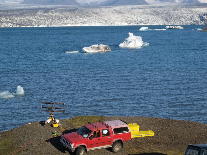
Figure: USF's School of Geosciences and the Geodesy lab operate a ground-based interferometric radar that operates at Ku-band (1.7 cm wavelength). The system is being used to study landslides, volcano flank stability, and the motion of glaciers. It was recently tested at Jokulsarlon, Iceland. Breidamerkuljokull, one of the main outlet glaciers for Vatnajokull, Iceland’s largest glacier, is in the background, flowing towards the instrument and calving icebergs into the lagoon. |
The University
of South Florida's Geodesy Laboratory uses microwave-based geodetic systems (GPS, satellite InSAR, and ground-based radar) to investigate changes in the Earth's land and water surfaces.
The geodetic data allow study of a variety of natural and anthropogenic processes,
including plate motion, strain accumulation
on earthquake faults, mountain building,
volcano deformation, and subsidence of urban and coastal areas. Our work is sponsored
by NSF, DOE, NASA and ONR.
![]() |
![]() |
![]() |
![]() |